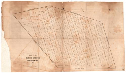
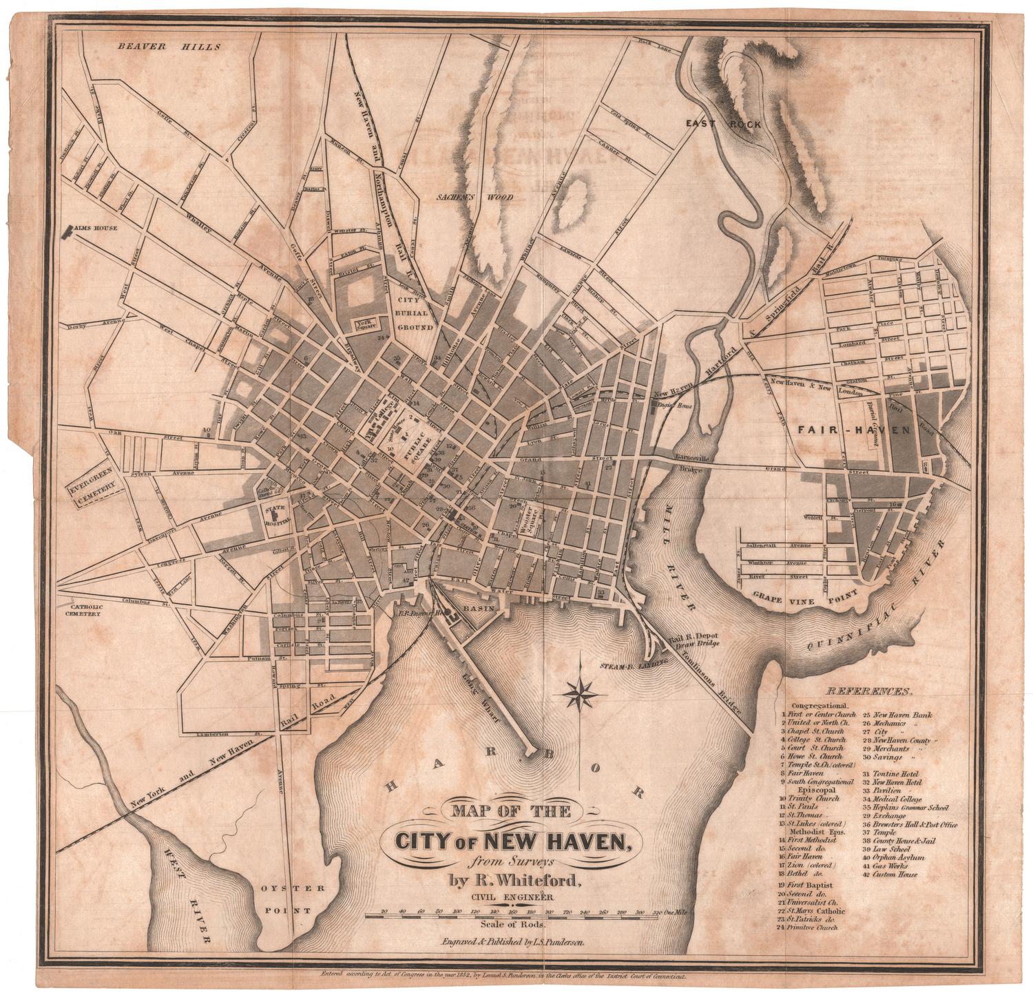
Plan of the Burial Ground
MakerMade by
Unknown
Date1839
MediumEngraving; printer's ink on wove paper
DimensionsPrimary Dimensions (image height x width): 13 x 21 1/2in. (33 x 54.6cm)
Sheet (height x width): 14 1/2 x 24 13/16in. (36.8 x 63cm)
ClassificationsGraphics
Credit LineConnecticut Museum of Culture and History collection
Object number2012.312.3
DescriptionMap of the burial ground in New Haven, Connecticut, showing numbered plots in twelve vertically-oriented, numbered tiers. The first tier is labeled United Society; the second, Episcopal Society; the third, Yale College; and the fourth, First Society. The fifth tier has plots for "Strangers" and "People of Color." The top left of the map has land that is designated for Yale College, monuments from the ancient burying ground, the Baptist and Methodist Societies, the city (presumably for the indigent), "People of Color," and "Strangers." To the north is Lock Street and the bank of the canal; to the east, Prospect Street; to the south, Grove Street; and to the west, Ashmun Street.
Label TextNew Haven's first cemetery was on the town Green, but by the late 1700s, it had become too crowded, and in 1797, the New Burying Ground--subsequently known as the Grove Street Cemetery--was established on what was then the outskirts of town. The new cemetery soon became a tourist attraction because of its innovative design. By the late 1830s, however, the new cemetery was suffering from vandalism and had begun to fall into disrepair; this 1839 plan shows its appearance at this point in time. In 1845, an imposing wall with a monumental gateway designed by architect Henry Austin, were erected to protect the cemetery from further damage.
NotesCartographic Note: 1 inch = ca. 60 feet ; Coordinates indicated.Cartographic Note: 1 1/2 inches = 100 feet
Subject note: The New Haven Burying Ground is now known as the Grove Street Cemetery.
This map is similar to 2012.312.4; this one appears to be a later rendering of the cemetery. The meadow and poplar grove that are shown in 2012.312.4 have been turned into more burial plots, and many of the plots that were available in the city squares have been numbered.
Status
Not on view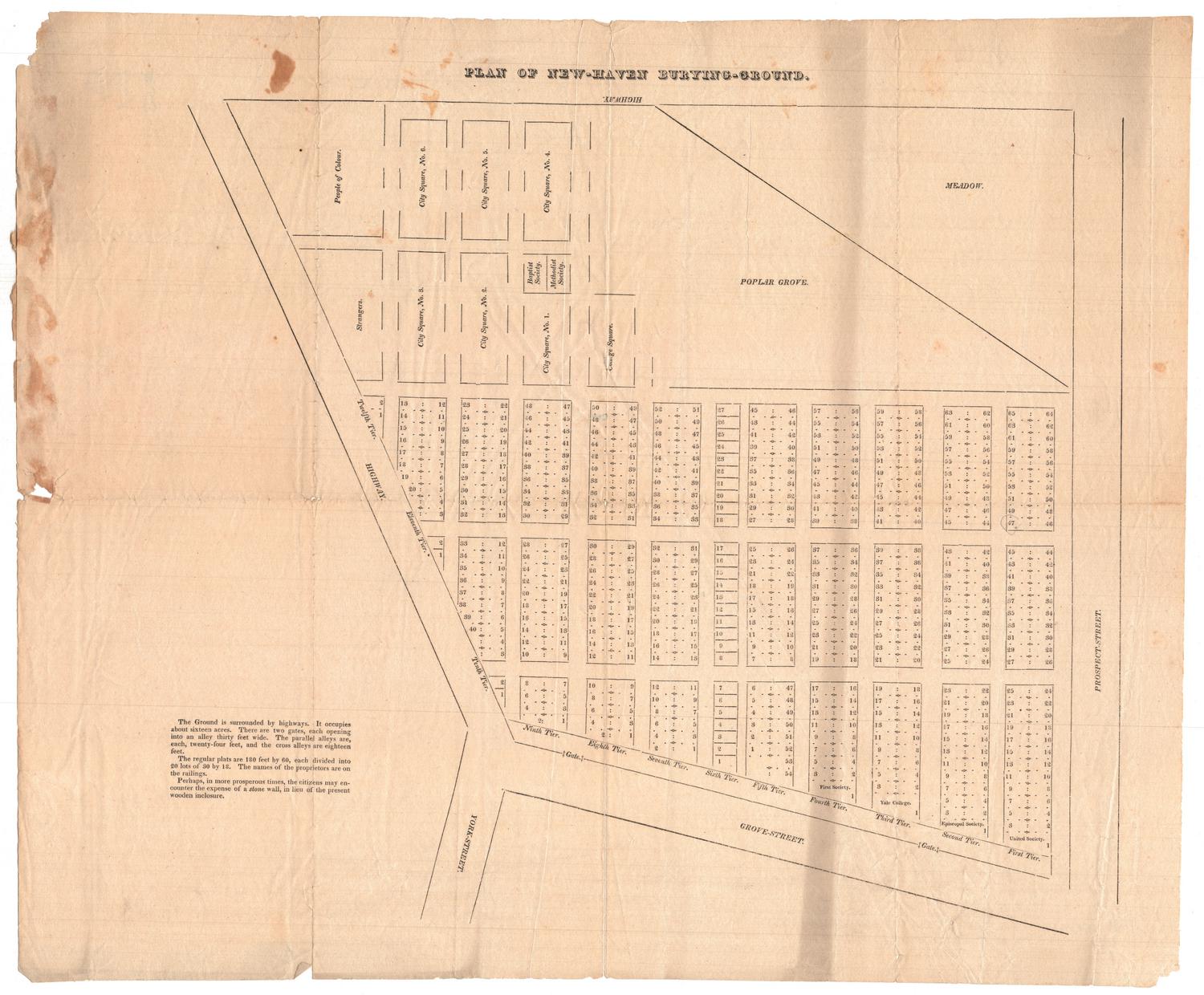

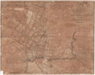

about 1823

Object/Object