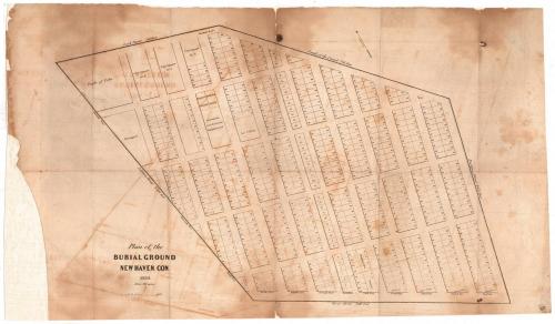
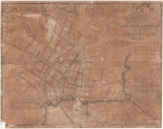
Plan of the Burial Ground
MakerMade by
Unknown
Date1839
MediumEngraving; printer's ink on wove paper
DimensionsPrimary Dimensions (image height x width): 13 x 21 1/2in. (33 x 54.6cm)
Sheet (height x width): 14 1/2 x 24 13/16in. (36.8 x 63cm)
Sheet (height x width): 14 1/2 x 24 13/16in. (36.8 x 63cm)
ClassificationsGraphics
Credit LineConnecticut Museum of Culture and History collection
DescriptionMap of the burial ground in New Haven, Connecticut, showing numbered plots in twelve vertically-oriented, numbered tiers. The first tier is labeled United Society; the second, Episcopal Society; the third, Yale College; and the fourth, First Society. The fifth tier has plots for "Strangers" and "People of Color." The top left of the map has land that is designated for Yale College, monuments from the ancient burying ground, the Baptist and Methodist Societies, the city (presumably for the indigent), "People of Color," and "Strangers." To the north is Lock Street and the bank of the canal; to the east, Prospect Street; to the south, Grove Street; and to the west, Ashmun Street.
Object number2012.312.3
NotesCartographic Note: 1 inch = ca. 60 feet ; Coordinates indicated.
Cartographic Note: 1 1/2 inches = 100 feet
Subject note: The New Haven Burying Ground is now known as the Grove Street Cemetery.
This map is similar to 2012.312.4; this one appears to be a later rendering of the cemetery. The meadow and poplar grove that are shown in 2012.312.4 have been turned into more burial plots, and many of the plots that were available in the city squares have been numbered.
On View
Not on view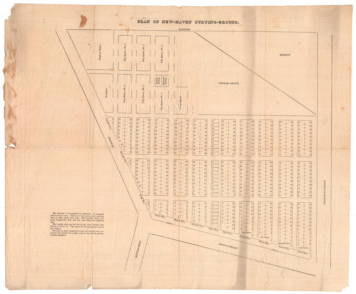
about 1823
Object/Object