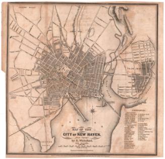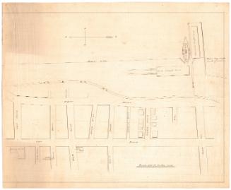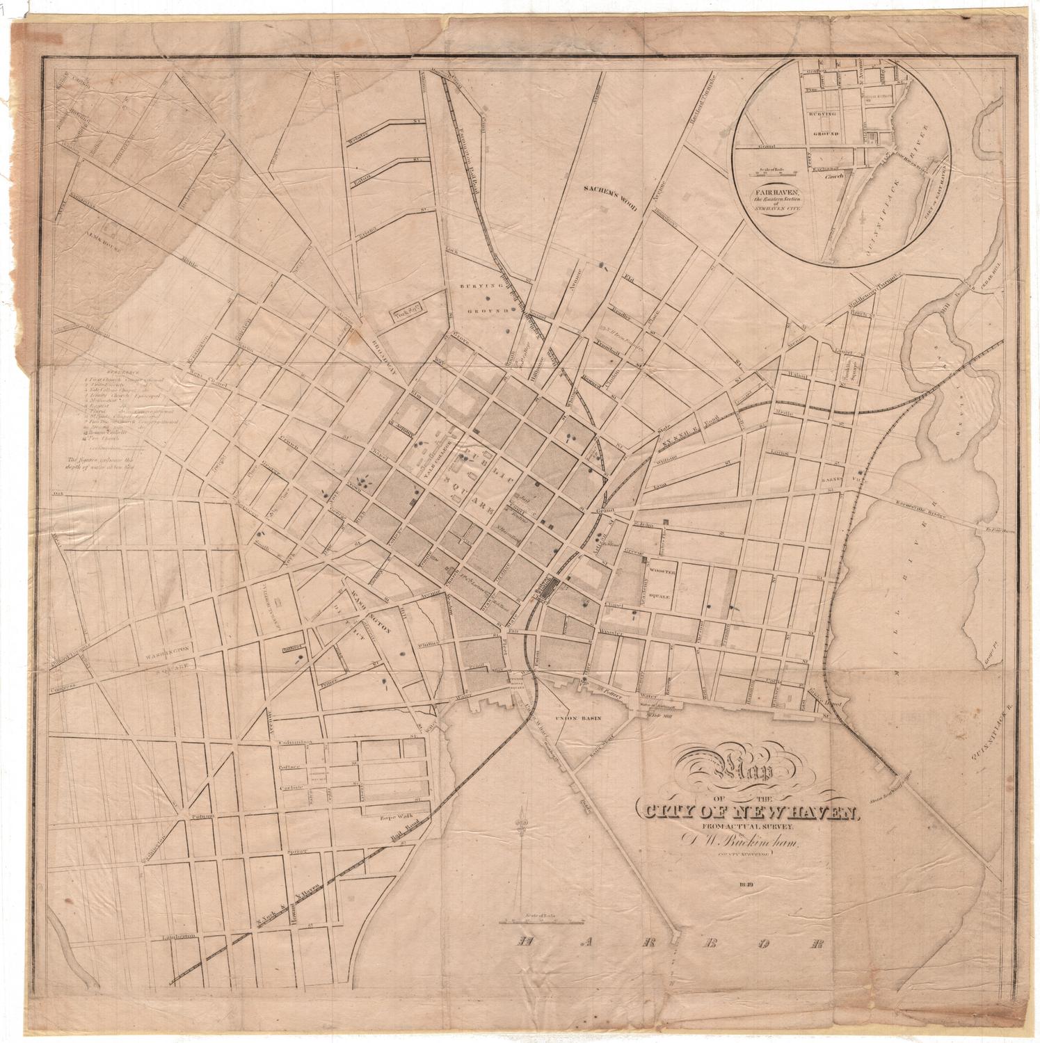
Map of the City of New Haven, From Actual Survey
DraftsmanDrawn by
David W. Buckingham
(1797 - 1886)
Date1849
MediumEngraving; black printer's ink on paper
DimensionsPrimary Dimensions (image height x width): 15 1/2 x 16 1/4in. (39.4 x 41.3cm)
Sheet (height x width): 16 1/2 x 16 7/16in. (41.9 x 41.8cm)
ClassificationsGraphics
Credit LineConnecticut Museum of Culture and History collection
Object number2012.312.2
DescriptionStreet map of New Haven, Connecticut, shows the city extending from the harbor to the south, the Mill River to the east, Sachem's Wood to the north, and West Street to the west. The Public Square or Green is in the center, and there is an inset of Fair Haven in the upper right corner. Notable landmarks include the Rope Walk, the New York & New Haven Rail Road and one station, the New Haven and Northampton Rail Road, the Farmington Rail Road, Union Basin and Union Wharf, a steam boat wharf and office, Yale College, and the burying ground (cemetery). The Reference list on the left provides the names of twelve churches whose corresponding numbers are found throughout the map.
Label TextCounty surveyor David W. Buckingham produced his first map of the city of New Haven in 1830. This 1849 map reflects the great changes that took place in the city in the intervening years. New Haven's first railroad, the Hartford and New Haven Railroad, began service from the New Haven steamboat landing to Hartford in 1839. During the 1840s, the New York and New Haven Railroad was constructed, linking New Haven with New York City and a third railroad line, the Farmington Railroad, was laid along the course of the Farmington Canal. All three railroads, and the new railroad station, completed in 1848, are prominently featured on this map along with the familiar grid of streets, the Green, and Yale College. The newly renovated Grove Street Cemetery is another sign of New Haven's civic pride during these ambitious decades.
NotesCartographic note: Scale: 60 rods to 1.375 inches (1 3/8 inches)Subject note: Sachem's Wood was the estate of James A. Hillhouse; it was located at the northern end of Hillhouse Avenue, at what is now Pierson-Sage Square. Hillhouse's father was known as "the Sachem" because of his Indian complexion and features.
The wharf identified as Union Wharf is now known as Long Wharf.
The Mill River joins the Quinnipiac River at the head of New Haven Harbor.
Status
Not on view