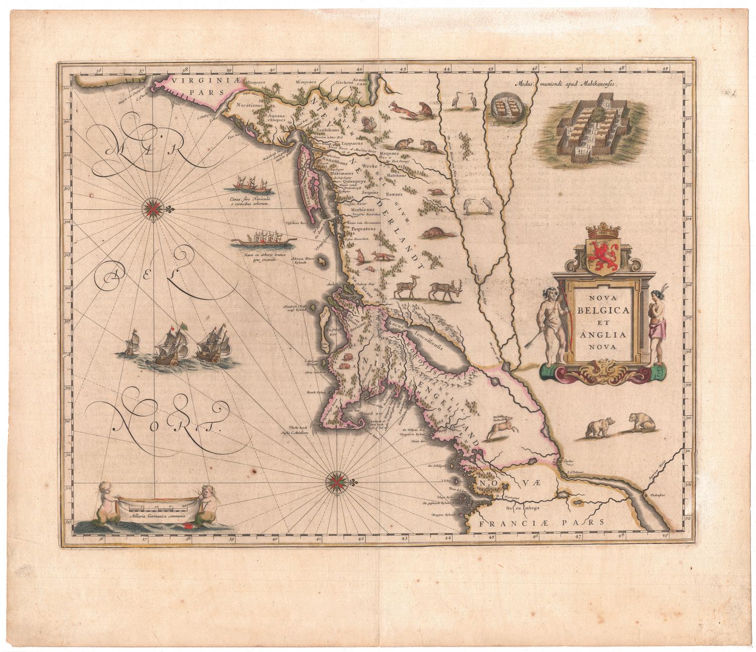
Nova Belgica et Anglia Nova
PublisherPublished by
Willem Janszoon Blaeu
(Dutch, 1571 - 1638)
Date1635
MediumEngraving; prnter's ink and watercolor on paper
DimensionsPrimary Dimensions (image height x width): 15 1/4 x 19 3/4in. (38.7 x 50.2cm)
Platemark (height x width): 15 3/8 x 19 7/8in. (39.1 x 50.5cm)
Sheet (height x width): 20 x 23 1/8in. (50.8 x 58.7cm)
Platemark (height x width): 15 3/8 x 19 7/8in. (39.1 x 50.5cm)
Sheet (height x width): 20 x 23 1/8in. (50.8 x 58.7cm)
ClassificationsGraphics
Credit LineThe Newman S. Hungerford Museum Fund
DescriptionMap of the east coast of the United States from the Chesapeake Bay to Quebec. The map is oriented east-west on the sheet, with the coastal land appearing at the top and right sides, and the Atlantic Ocean making up the bottom and left sides. New Amsterdam, Fort Orange (along the Noord Rivier, or North River, which is what the lower part of the Hudson River was called) and New Plymouth are the three settlements or forts that are labeled and marked with symbols. Rivers, lakes, and bays are named, and the names of Native American tribes and the locations of their settlements are provided, denoted by small clusters of wigwams. Forests are depicted as groups of trees, and elevation is conveyed through the depiction of mountains. Representations of deer, turkeys, herons, beavers, otters, foxes and rabbits are scattered around the land area. In the top right corner is a depiction of a wigwam village. The area comprising the Atlantic Ocean is embellished with canoes, ships and two compass roses. The decorative cartouche is flanked on either side by Native Americans, and the scale marker at the bottom left is flanked by cherubic mermaid figures.
Object number2012.172.1
NotesCartographic Note: The scale shows measurements in increments of 5, from 0-20, and is accompanied by the phrase "Milliaria Germanica communia"On View
Not on view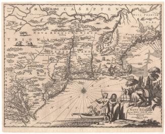

H. F. Sumner & Co.
1833